appdownload.guide
APP
Navionics® Boating
Garmin
2.6(42.2K)
5M Downloads
Maps & Navigation
Ratings & Reviews
2.6
42.2K Reviews
5★
13.4K
4★
2.7K
3★
1.8K
2★
3.9K
1★
20.4K
App Info
DeveloperGarmin
CategoryMaps & Navigation
Downloads5M+
PriceFree
Updated2025-10-20
Key Features
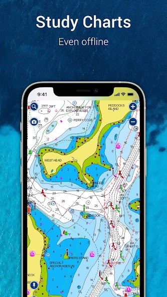
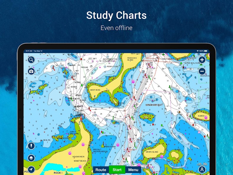
Access internationally renowned Navionics® charts offline for detailed marine reference.
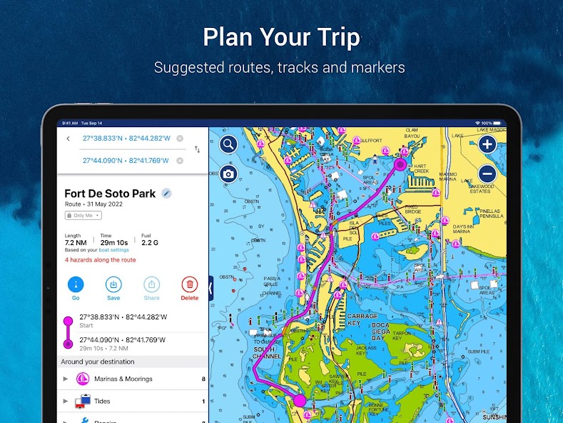
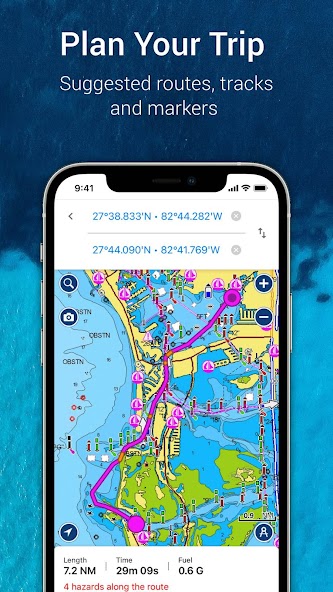
Plan trips effortlessly with Auto Guidance+TM technology providing suggested dock-to-dock paths.
Contribute and obtain local knowledge through Community Edits and ActiveCaptain® Community.
Sync app with compatible devices for more features like SonarChart live mapping and AIS connectivity.
Receive notifications for hazards along the route path and possible collisions when connected to AIS devices.
Screenshots


Trailer
Discover the power of Navionics® Boating, where features meet innovation. Whether you're cruising, fishing, sailing, or diving, this app is your ultimate companion on the water. With detailed charts that work offline and a plethora of tools at your fingertips, you'll always stay ahead of the game.
Imagine effortlessly planning your day on the water with Auto Guidance+TM Technology. Receive suggested dock-to-dock paths, ETA calculations, fuel consumption insights, and more based on real-time chart data. No more guesswork – just smooth sailing all day long.
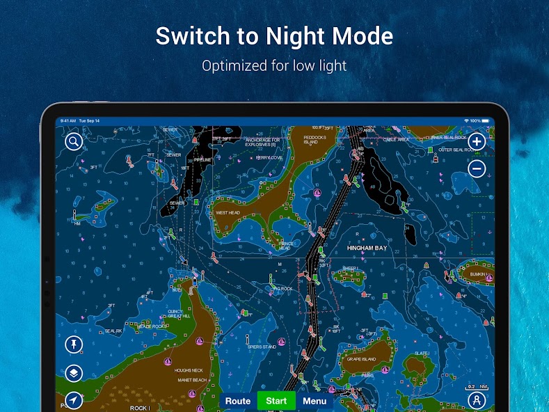
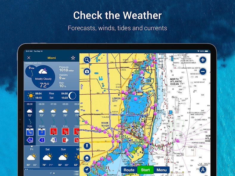
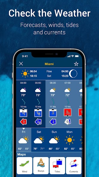
Stay one step ahead of Mother Nature with real-time weather updates and tidal information. Know exactly what conditions to expect before you set sail. Mark special spots along your journey, record tracks with photos and videos, and easily measure distances between points for a seamless experience.
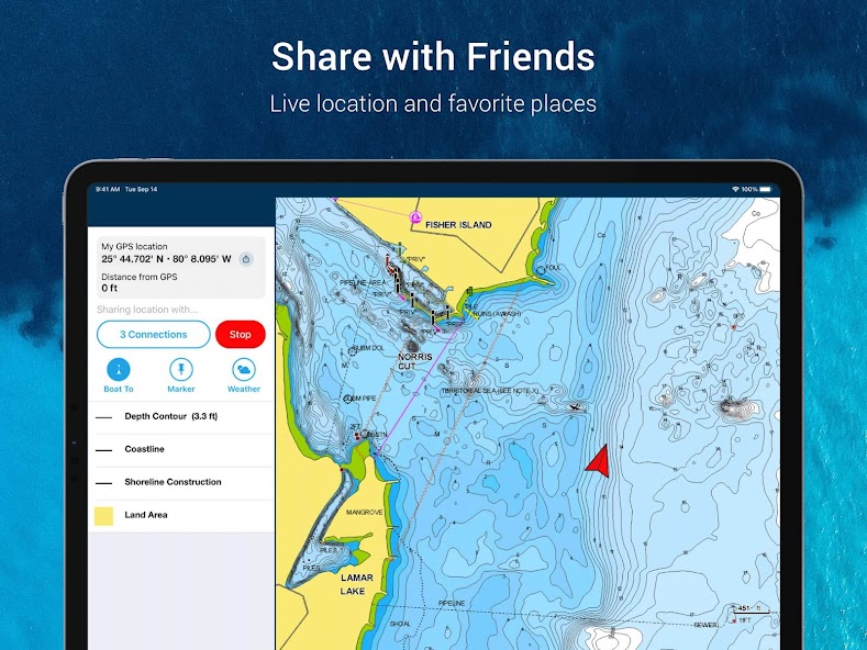
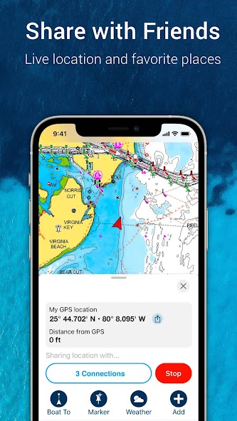
Join a vibrant community of boaters through Community Edits and ActiveCaptain® Community. Share local knowledge, points of interest, and navigation tips with fellow enthusiasts. Connect with friends on the water by sharing live locations and routes – because adventures are better when shared.
Sync your compatible devices seamlessly with Plotter Sync and SonarChart Live Mapping Feature. Take advantage of AIS connectivity to monitor nearby marine traffic for enhanced safety during your trips.
The latest update brings even more value by displaying potential hazards along your route path in detail screens and providing notifications for hazards during navigation and possible collisions when connected to AIS devices.
Experience the future of boating navigation today with Navionics® Boating – download now and elevate your time on the water like never before!
About This App
Introducing Navionics® Boating, the ultimate Maps & Navigation app for all your aquatic adventures. Whether you're cruising, fishing, sailing, or diving, this app is your go-to companion on the water. With detailed offline charts and a plethora of features, you'll always have the information you need at your fingertips.
1. **Core Functionality: **
Navionics® Boating provides up-to-date charts and a variety of tools to enhance your boating experience.
2. **Key Features and Benefits: **
- Access internationally renowned Navionics® charts offline
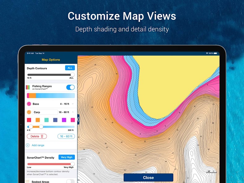
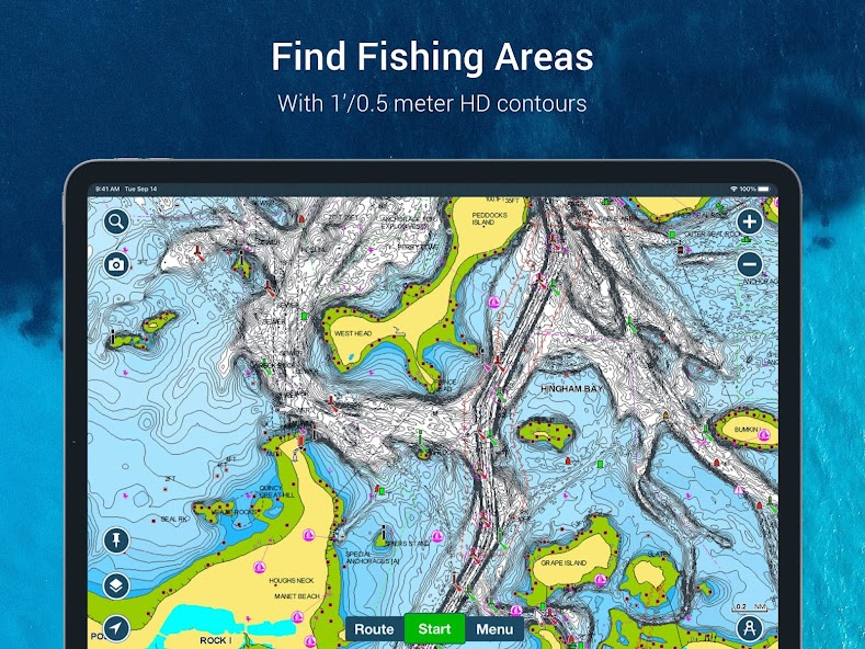
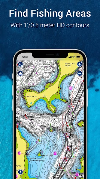
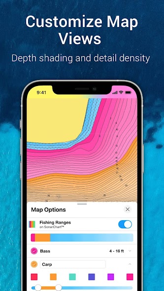
- Utilize SonarChart™ HD bathymetry maps for detailed bottom contour information
- Benefit from U.S. Government charts (NOAA) within specific coverages
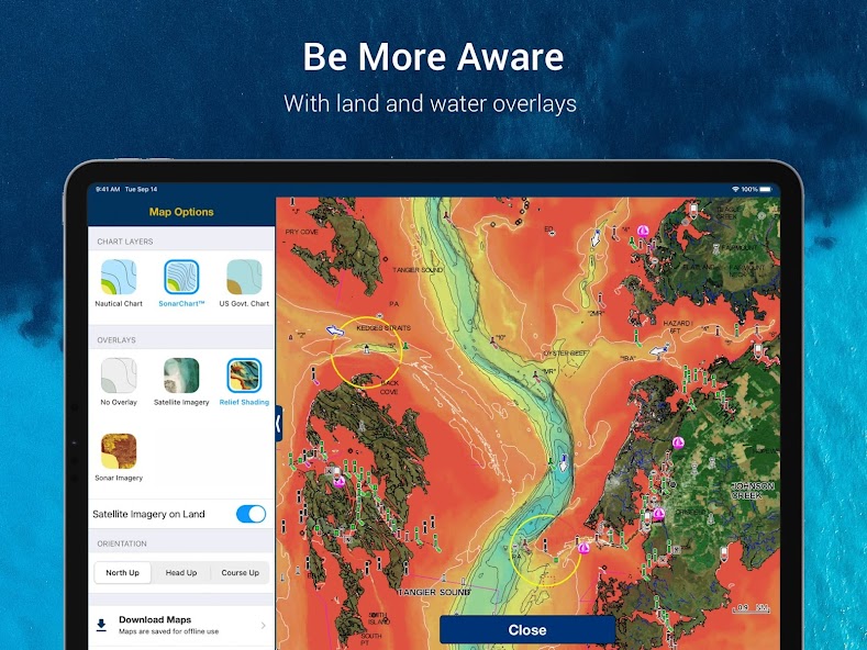
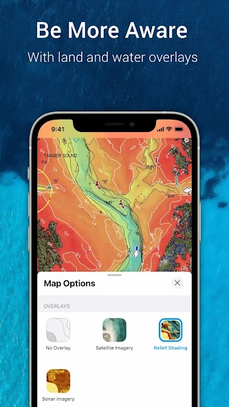
- Customize chart views with various overlays including relief shading and satellite imagery
- Plan trips using Auto Guidance+™ technology for suggested routes and essential trip data
- Stay informed with real-time weather updates, tides, markers, tracks, and distances
3. **Real-World Use Cases: **
- Plan a fishing trip with precise bottom contour details
- Navigate safely with suggested routes and real-time weather updates
- Share locations and connect with fellow boaters in the ActiveCaptain® community
4. **Technical Specifications: **
- Compatible with devices running OS 10 or higher
- Tablet devices with Wi-Fi connectivity can approximate positions when connected to Wi-Fi
5. **User Testimonials: **
"Navionics® Boating has completely transformed how I navigate on the water. The detailed charts and real-time weather updates are invaluable." - Sarah J.
6. **Call to Action: **
Experience the power of Navionics® Boating today and elevate your boating adventures like never before!
What's New
Check out the latest update!Now, you can view potential hazards on your route and receive notifications for dangers while navigating or potential collisions if connected to AIS devices. Stay informed and stay safe with these new features.
Our Review
This app is a versatile companion for all your water activities, offering detailed offline charts and a range of useful features.
Key Strengths:
The inclusion of internationally renowned Navionics® charts ensures accurate navigation above and below the water's surface.
Tools like Auto Guidance+™ simplify trip planning with valuable data on distance, ETA, and more.
Areas for Improvement:
Enhancing user interface intuitiveness could improve overall user experience.
Adding more interactive elements for community engagement might enhance the app's social aspect.
In conclusion, Navionics® Boating provides essential tools for boaters, anglers, and sailors alike. While it offers a comprehensive set of features, some refinements could elevate its usability further.
User Reviews
Aisha Patel
May 29, 2025
As a sailor, I appreciate the detailed nautical charts provided. However, the weather forecasts could be more accurate and timely.
Ethan Wong
May 29, 2025
I love using Navionics for diving excursions. The community edits feature is invaluable for discovering new dive sites shared by fellow divers.
Isabella Costa
May 29, 2025
The auto guidance technology saves me time while cruising. It's a game-changer, but occasional glitches need fixing for a seamless experience.
Liam O'Connor
May 29, 2025
Navionics Boating is fantastic for planning fishing trips. The sonar imagery is top-notch, but I wish the interface was more intuitive.
Mohammed Khan
May 29, 2025
Navionics has greatly enhanced my boating adventures with its plotter sync feature. Sharing routes with friends has never been easier! Definitely recommend it.
Ratings & Reviews
2.6
42.2K Reviews
5★
13.4K
4★
2.7K
3★
1.8K
2★
3.9K
1★
20.4K
App Info
DeveloperGarmin
CategoryMaps & Navigation
Downloads5M+
PriceFree
Updated2025-10-20
Key Features
Access internationally renowned Navionics® charts offline for detailed marine reference.
Plan trips effortlessly with Auto Guidance+TM technology providing suggested dock-to-dock paths.
Contribute and obtain local knowledge through Community Edits and ActiveCaptain® Community.
Sync app with compatible devices for more features like SonarChart live mapping and AIS connectivity.
Receive notifications for hazards along the route path and possible collisions when connected to AIS devices.